

You can find on this page the Greece trains map to print and to download in PDF. The Greece railways map presents the rail network and shows high speed rails routes of Greece in Europe.
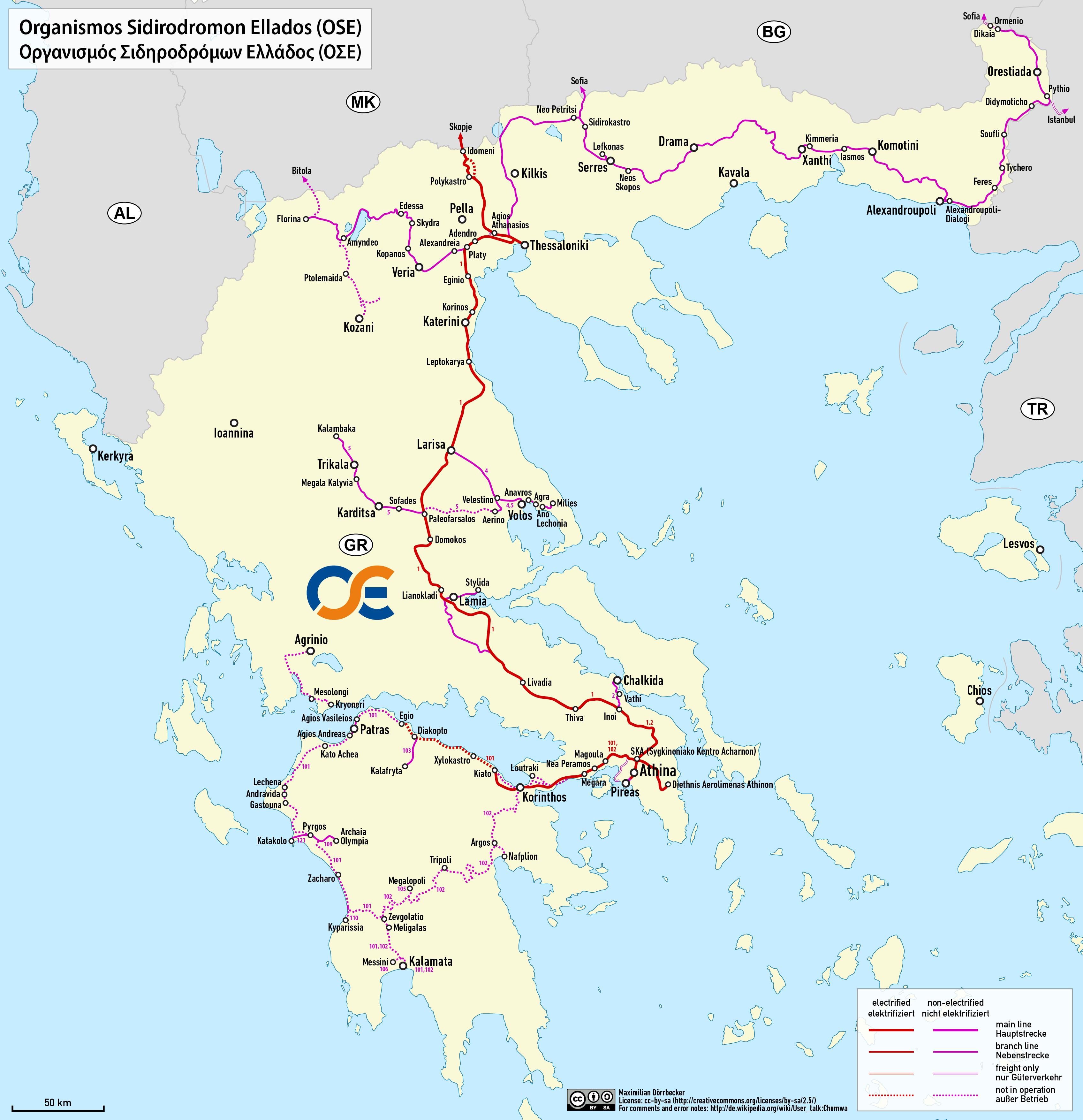
The Greece rail map shows all the railway stations and lines of Greece trains. This train map of Greece will allow you to easily travel by train in showing the major rail routes and high speed rail routes of Greece in Europe. The Greece rail map is downloadable in PDF, printable and free.
The Railways of Greece have a complex history which starts in 1869, with Athens & Piraeus Railway. A number of railway lines were constructed mainly by mining operations and by extenisive industrial facilities as its mentioned in Greece rail map. A few were also temporary lines used for the construction of major public works. Most of them were either metre gauge or 600 mm (1 ft 115⁄8 in).
Since the 1980s, the road and rail network of Greece has been significantly modernized as you can see in Greece rail map. Railway connections play a somewhat lesser role in Greece than in many other European countries, but they too have also been expanded, with new suburban/commuter rail connections, serviced by Proastiakos around Athens, towards its airport, Kiato and Chalkida; around Thessaloniki, towards the cities of Larissa and Edessa; and around Patras.
A modern intercity rail connection between Athens and Thessaloniki has also been established, while an upgrade to double lines in many parts of the 2,500 km (1,600 mi) network is underway as you can see in Greece rail map. International railway lines connect Greek cities with the rest of Europe, the Balkans and Turkey, although as of 2011 they have been suspended, due to the financial crisis.