

You can find on this page the Greece road map to print and to download in PDF. The Greece driving map presents the detailed road network, main highways and free motorways of Greece in Europe.
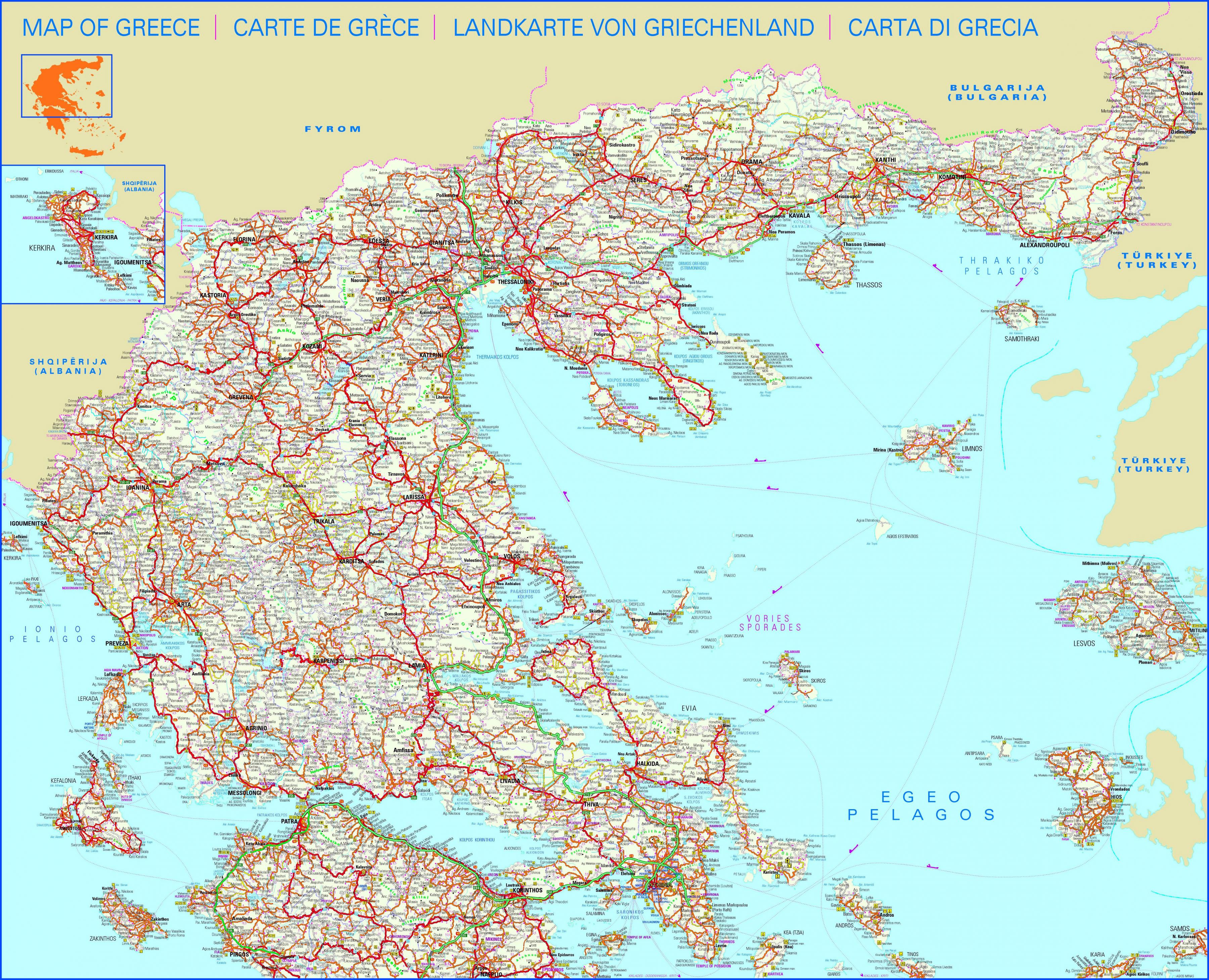
The Greece road map shows all roads network and main roads of Greece. This road map of Greece will allow you to preparing your routes and find your routes through the roads of Greece in Europe. The Greece roads map is downloadable in PDF, printable and free.
The old “national road” network and rural roads connect smaller towns and villages as you can see in Greece roads map, while narrow paved paths, and dirt roads provide access to more remote parts of Greece. A network of newly built, European standards toll roads, will allow you travel comfortably and safely from Thessaloniki in Macedonia all the way to Kalamata in the Peloponnese.
The Ionia Odos will get you from Igoumenitsa in Epirus to Patra or border with Turkey in Thrace via the Egnatia Odos, while the Olympia Odos will allow you to drive from Patra to Athens in a couple of hours as its shown in Greece roads map. These roads will be the backbone of any trip that requires driving in Greece. They have rest stops and toilets at regular intervals, while their exits serve most major cities along the way. Rural roads are usually in poor condition, with fainted lines and unreliable signage.
The old interstate system connects most of Greece as its mentioned in Greece roads map with paved roads that were built to meet the driving needs more than 50 years ago. They are in disparaging states of repair, and in general you will find them inadequate for today cars and density of traffic. These roads consist of one lane per direction, with only the painted line in the middle to separates cars moving in opposite directions.
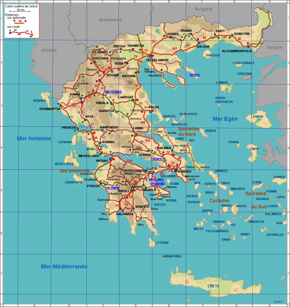
The Greece highway map shows toll and free motorways of Greece. This highways map of Greece will allow you to prepare your routes on motorways of Greece in Europe. The Greece highway map is downloadable in PDF, printable and free.
The newly built highways are a joy to drive on, while the older road network that includes the so-called national roads will be a source of considerable stress. The downside is that there are few roads that would qualify as highways on Crete as you can see in Greece highway map- only the National Road and a small part of the north-south road running from Heraklion to Moires offer a highway-like driving environment.
There are very few multiple lane highways or super-highways in Greece. Unless otherwise specified, speed limits as its shown in Greece highway map are 50 km/h (or 32 mph) on residential streets, 90 km/h (56 mph) out of town and 110-120 km/h (69-75 mph) on highways and freeways (motorways). It should be noted that there are no freeways (motorways) on any of the islands. Many drivers do not respect the speed limits, particularly on the larger straight roads. On multi-lane highways or roads with a shoulder lane, a law abiding tourist driving at 110 km/h should not be surprised to see cars whiz by at 130 km/h (82 mph) and faster.
Since Greece is the operation of motorway sections and toll cares about 6 different companies, there is the situation with road tolls complicated than in other European countries. Individual companies do not just build and repair highway sections (see Greece highway map), but also the toll. Toll fees are the drivers of motorcycles and vehicles over 3.5 tons collected during each pass toll gates.